
The Greater Wichita Economic Development Coalition (GWEDC) has launched its new buildings and sites database utilizing the custom designed FastGIS 2.0 Professional application built by FastFacility. Branded as Location Scout, the GWEDC FastGIS database covers a vast region of 10 counties and approximately 100 communities in Kansas, and is one of the largest regional economic development GIS applications in the Midwest.
In an extremely competitive RFP process that included presentations from more than eight GIS providers, FastFacility won the bid and is now providing GWEDC with the most comprehensive GIS solution available today.
- GWEDC presented an interesting challenge for FastGIS. The client required a GIS solution that could:
- • Produce multiple demographic report packages for the region and their county partners
- • Produce sophisticated mapping capability
- • Provide a dynamic listings platform to attract the participation of their area real estate brokerages.
FastGIS met these demands and at a price point that allowed GWEDC to make a confident three year commitment to this GIS solution.
"Our most significant role as economic developers is to provide site selectors with comprehensive information about our region. We selected FastFacility/Fast GIS to develop LocationScout. LocationScout provides information on every site and building in our region. Our area partnership helped us create a user-friendly, high powered search engine with advanced GIS features like Bird's Eye and Street View. LocationScout allows users to build custom reports on demographics, infrastructure and transportation and locate area businesses. LocationScout provides a one-stop portal to demonstrate how the Wichita area can benefit companies and their investments." - Vicki Pratt Gerbino, President, GWEDC
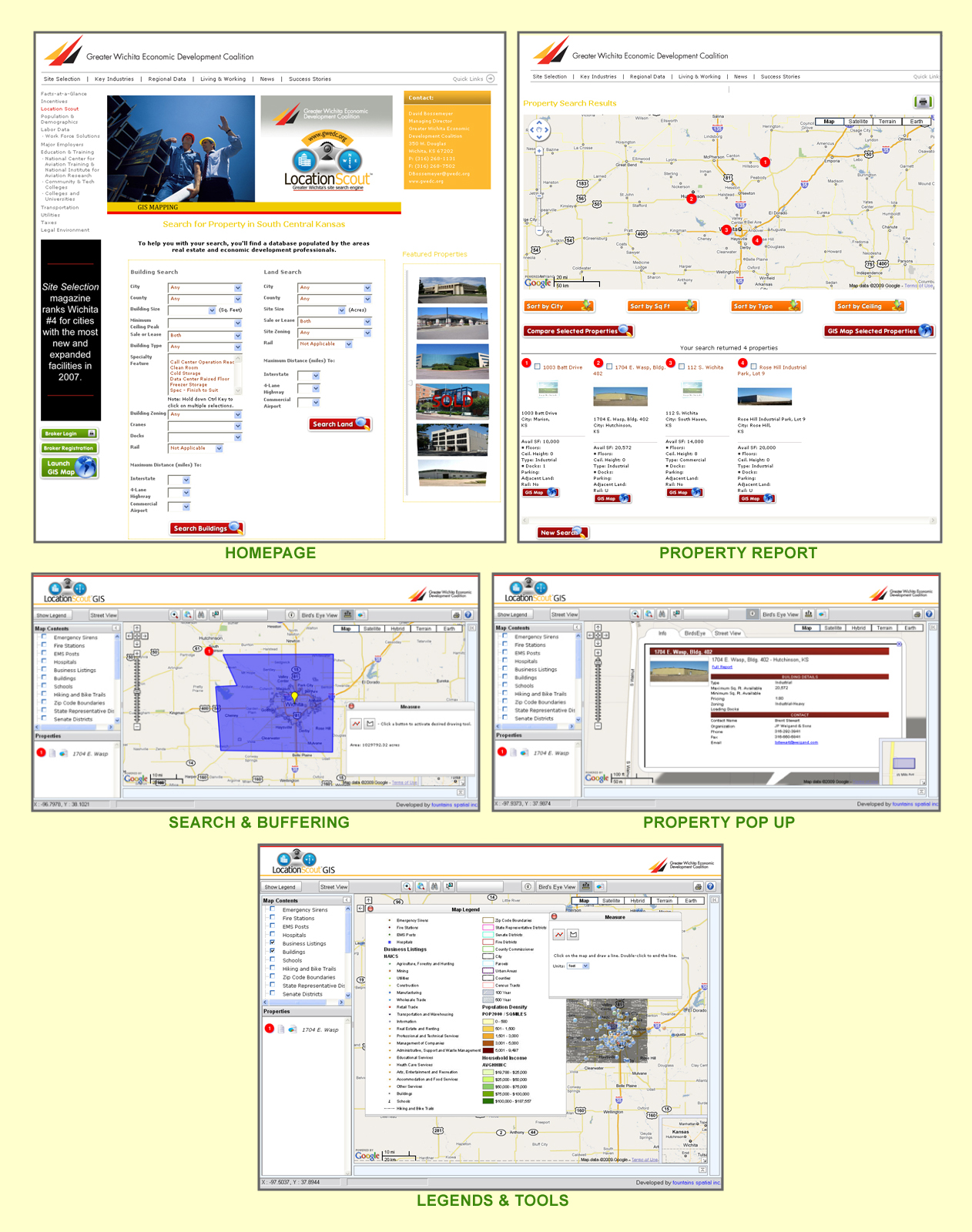
GWEDC Location Scout will make an impact on those interested in the Wichita market place because of its regional scale, but also because it brings to the user an expansive regional and local application with robust GIS functionality and the ability to perform precise demographic analytics. The GWEDC Location Scout website includes features and functionality not commonly offered in most competing applications. For instance FastGIS features include a robust measuring tool that allows users to do either linear or polygon measurements on any map or image and an exclusive buffering tool with the capability to create detailed analysis and reports of surrounding areas to any parcel or building. Both features are exceptional tools for your research and business development teams when preparing prospect presentations.
Pricing was an important GWEDC concern. Purchasing outsourced demographic data can dramatically drive up the annual cost and apply usage limitations. FastGIS provides its own demographic data that will save GWEDC thousands of dollars in annual demographic costs. But more importantly FastGIS data also allows the user radius demographic capability from any point in the GWEDC's jurisdiction and extend the radius or drive time distances well beyond their geo-political boundaries- in their case radii can extend throughout Kansas as well as into neighboring Oklahoma.
The Witchita Eagle
Witchita Business Journal
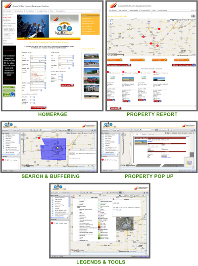
 CLICK TO ENLARGE

We’ll show you how your organization can benefit by using FastGIS to more effectively market your community against the competition.
Please fill out the form below and we will contact you to arrange a demo. All requests and contact information will remain confidential and private and will be used only for the purposes of contacting you to arrange for a FastGIS demonstration.

Most advanced and affordable GIS application to date for the Economic Development and Planning professions
- • Built on the latest ESRI GIS technology, ArcGIS Server 9.3. Most other Economic Development applications are built on ArcIMS, which is more limited and no longer supported.
- • Sophisticated measuring tools providing point to point analysis “on the fly”
- • Demographic Distance and Drive Time Radius Reports from anywhere on the map
- • Larger map display, providing better map clarity and map extent with a tighter zoom-in level for a more professional and pleasurable user experience.
- • Menus are collapsible providing even better map look and feel
- • Superior performance based on efficient and modern design architecture
- • Mobile access and smart phone capabilities in the field giving your staff the tools to respond to prospects more quickly.
- • Birds Eye (2-300 angled view), Google Street View and Google Earth integration providing a true to life visual experience – not just from a thousand feet up but view buildings from angles and the side.
- • Web services that enable us to update your data in real time bringing you advantages that increase data quality and lower maintenance cost.